Startups we love, we validate, we partner with and then the ones we fund.
Have you ever measured the temperature of bare soil to ANY plant cover…
it’s very eye opening.

So far, since we bought the first voluntary soil carbon credit in Australia in 2006 there have been thousands of scientific papers and studies globally to come to some form of consensus as to what is sequestered carbon and how we should measure it.
But that’s not a patch on our partner Nori.com who’s cofounder started carbon credits in Canada in 1992!
Now and industry best practice Nori are a innovator in the sector that focuses on seeing the farmer or steward of the sequester carbon gets the lions share of the credit not the auditors snd compliance intermediaries.
To be clear, there are a lot of variables, but key is the need for us to support efforts to get life happening in the top 30 cms (1 ft) of all arable soil and then focus on how to keep developing the land to at least 1 meter (3ft or 1 yard) depth as per the agreed govt sequestration models. Please click here to read the 2018 Australian Govt model; future models will be listed as they come on line.
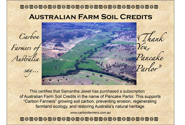
first Australian voluntary soil carbon credit certificate

UNEP/GRID-Arendal—From Collection: IAASTD—International Assessment of Agricultural Science and Technology for Development. 2008
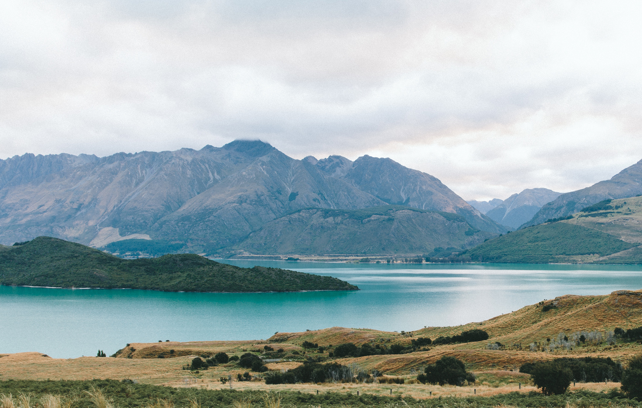
Such depths of topsoil were what we started our agricultural beginnings, now destroyed and turned to deserts in many parts of the world.
“Economic pressures can lead to the overexploitation of land and usually hit the poor the hardest. Forced to extract as much as they can from the land for food, energy, housing, and source of income, they are both the causes and the victims of the desertification. Desertification brings hunger and poverty. People living in areas threatened by desertification are forced to move elsewhere to find other means of livelihood. Usually they migrate toward urban areas or go abroad. Mass migration is a major consequence of desertification. From 1997 to 2020, some 60 million people are expected to move from the desertified areas in sub-Saharan Africa toward Northern Africa and Europe.”
M.K. Doula, A. Sarris, in Environment and Development, 2016
“Desertification ultimately reduces the sustainability of arid lands whereby agriculturally productive lands become barren and thus prone to wind and water erosion and other forms of land degradation….
Desertification has occurred because desert ecosystems, which cover over one third of the world's land area, are extremely vulnerable to overexploitation and inappropriate land use, compounded by poverty, political instability, deforestation, overgrazing, and wasteful irrigation practices. According to UNCOD, over 250 million people are directly affected by desertification. In addition, some 1000 million (or 1 billion) people in over 100 countries are at risk. These people include many of the world's poorest, most marginalized, and politically weak citizens.”
V.P. Tchakerian, in Encyclopedia of Atmospheric Sciences (Second Edition), 2015
We need to support farmers
to regenerate soils faster than nature can do this naturally at a rate of 2cm(1inch) every 2000 years!
In Australia we have some of the most innovative, if remote, farmers achieving this over periods of 30 plus years ( click here to watch one of these extraordinary achievements) but we can help innovative farmers do it faster with funds and market support.
But waiting for a perfect measuring system and making it impossibly difficult for the farmer is NOT in all our best interest. Many regions of the earth will never rain enough to achieve the measurements required by the current system; estimates are that it is not viable under 2 tonnes of sequestration which is only possible in high rainfall areas, so climatefood is dedicated to finding ways to still support carbon sequestration and see the farmer is paid on a pro rata basis. Making it viable is therefore a key driver for economic success and our survival as a species.
Given our early involvement in this area and our group’s collective commitment, it would seem this is in all our interest.
No amount of pounding the streets will quickly change our ways, nor the rich to let go their strong hold of fortunes built on cutting, burning and poisoning their way to great riches. So if we are to create fast change, it must come from innovation and B2B premiums created through niche market shopping! In order to further this we need to provide value to the shopper that good works done are true and valid. To this end we are reaching out and creating a standard of carbon and water health that the shopper can be a part of.
To date, Climatefood has partnered with several local service providers as pictured in this graphic which can be expanded to your local service provider here we accumulate the data for you, manage the connections and encode the data in the blockchain for validation and carbon emission trading security:

So far we have several startups in the pipeline with one we have looked at for several years that is still not ready but who aims to be an affordable satellite monitoring system out of Europe, compliant with each nation’s protocols for the COP21 standard plus the individual variables each farmer may request. These things take many years to validate with governments so we are watching this and others in the global satellite community.
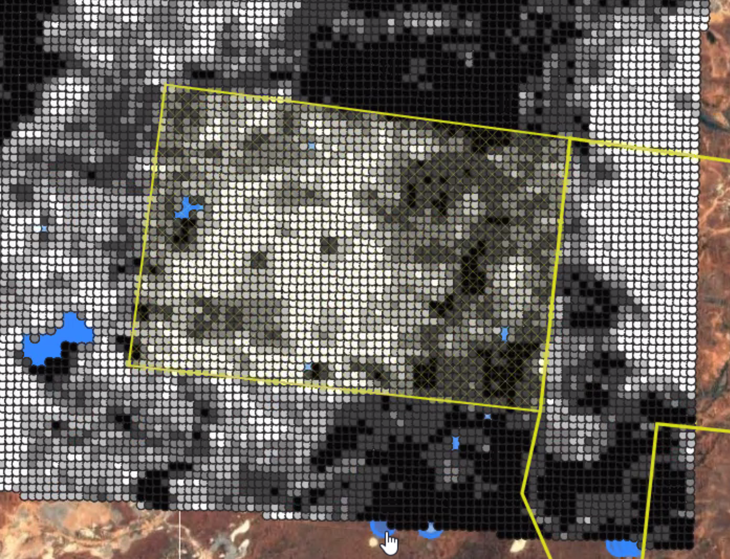
Measuring soil carbon from satellite in the desert where land management is the only variable.
These services are able to be booked as a portal through us at climatefood tailored to your individual needs and giving you visual and data access to your land every 8 days. The remote portal will be able to give you all the following data over a unit or part unit areas of 4000 hectares for a very low p.a. fee, a tenth the cost of its competitors.
Aggregated Carbon levels down to 30 cms below the soil collected every 8 days and calculated per annum excluding trees and non viable terraform like rock and river.
Humidity or moisture in the soil vital for life
Soil surface temperature (albedo)

Hand scanners assist with instant carbon measures through an AI but do not replace soil carbon verification to 1 meter depth
The next will be ecological measuring on the ground and core samples, through several soil collection services, followed closely by in-hand scanners to take the lab into the field and save time and heavy shipping costs of the core samples. We have a couple of these in the pipeline so far as many will be needed to measure the soil globally! We can put you in touch with these in your local area. this will be particularly important for international buyers and farmers.
For the public scanning from your phone for toxins and nutrients is the way of the future
watch here for this great startup we have aligned with out sometime next year!
For enquiries about being listed with out sister ecommerce eco company urth.io to market your product or white labelling.
